UPDATE 7 p.m.
The Central Okanagan Emergency Operations Centre has downgraded some of the wildfire evacuation orders in West Kelowna Wednesday evening.
The following properties on Horizon Drive now within evacuation alert areas: 2210, 2149, 2155, 2182 and 2232
South of Shannon Lake Road and Alexandria Way, properties from 2890 through to 2972 Shannon Lake Road are on alert
On Shannon Lake Road, the following properties have been downgraded to an alert: 2735, 2649, 1850 and 2025
All properties along Alexandria Way are now on alert.
And all properties along Moore Drive, Shawna Court, Helgason Drive, Golf Course Drive, Shannon View Drive, Cornerstone Drive and Hedgestone Drive are on evacuation alert now.
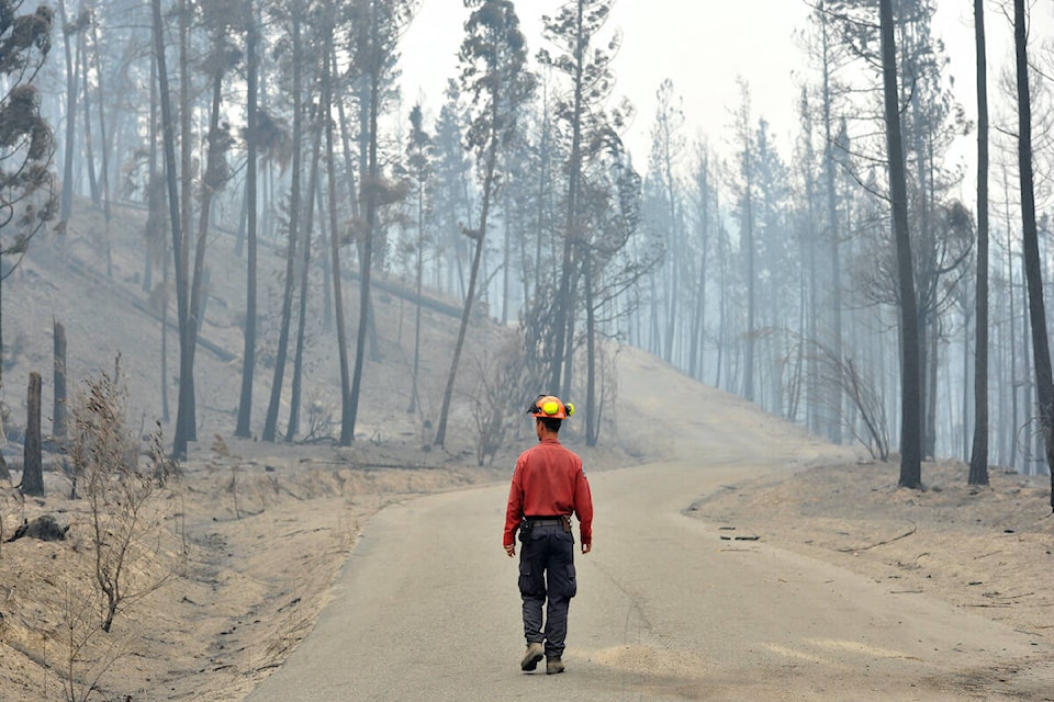
The McDougall Creek wildfire is now listed at 12,318 hectares, according to BC Wildfire Service as of 5:43 p.m.
Aerial operations started up again Wednesday, Forests Minister Bruce Ralston said during a provincial wildfire update. He said aerial operations had been playing a limited role due to poor visibility.
“Wildfire smoke conditions and visibility have significantly improved over the past 24 hours with the growth complex of fires wildfires in the Okanagan Valley.”
UPDATE 10 a.m.
As smoke lifts in West Kelowna, aerial operations will resume on Wednesday, according to BC Wildfire Services.
On Wednesday, crews will continue structure protection, including extinguishing hot spots close to structures. They will also continue to run sprinkler systems to increase relative humidity in areas where the fire hasn’t reached property lines. Crews will also work on extinguishing the fire’s edge behind the West Kelowna Road neighbourhood.
Heavy machinery has finishing constructing a line between Shannon Lakes Estate and Bartley Road and crews will continue with small hand ignitions. Line locators are also working with the machinery to connect the fire’s edge in an old fire scar from 2015.
BC Wildfire crews are also working with BC Hydro to extinguish burning powerlines and clear road access.
For the first time since the fire expanded, BC Hydro crews have turned the power back on the Rose Valley Dam and are restoring power to the city’s water treatment chlorinator.
Because the smoke kept temperatures cooler the last few days, the fire has been burning at a rank 2 (low) with pockets at rank 3 (moderate). As the smoke disappears and despite cooler temperatures, fire crews are expecting increased fire activity on Wednesday as sun will directly reach the already dry ground levels.
According to BC Wildfire Services, West Kelowna received two millimetres (mm) of rain of Tuesday while Fintry experienced 6.2 mm.
Original
Through Tuesday night and into Wednesday morning, the McDougall Creek wildfire has seen no changes.
As the weather improved throughout the day on Tuesday, the smoke lifted and BC Wildfire Services were able to update the size of the blaze, which now sits at 12,270 hectares.
On Tuesday, crews and structure protection continued to work to battle the fire and focused on hot spots close to properties or properties lines. Heavy machinery was also used in many areas to help construct machine guards. The fire continued to burn at a ranks 2 and 3, meaning low to moderate.
Canada Task Force 1 assessed approximately 500 properties for damage in the area of the McDougall Creek wildfire and West Kelowna Fire Chief Jason Brolund said he expects less than 90 structures to be lost in West Kelowna and on Westbank First Nation lands.
All evacuation orders and alerts remain the same going into Wednesday, according to Central Okanagan Emergency Operations. For a map of evacuation orders and alerts visit cordemergency.ca/map.
The McDougall Creek fire in West Kelowna is part of the Grouse Complex, which also includes the Walroy Lake wildfire in Kelowna and the Clarke Creek wildfire in Lake Country.
Transport Canada and the BC Wildfire Service prohibit the use of drones of any size near a wildfire. The operation of any aircraft not associated with fire suppression activities within a radius of five nautical miles around a fire, including unmanned aerial vehicles (UAVs or drones), is illegal. Anyone found interfering with wildfire control efforts may face penalties up to $100,000 and or up to one year in jail.
Black Press Media will keep updated throughout the day.
READ MORE: Premier Eby tours wildfire devastation in Central Okanagan
@cunninghamjordy
jordy.cunningham@kelownacapnews.com
Like us on Facebook and follow us on Twitter and subscribe to our daily and subscribe to our daily newsletter.