There’s only one main road into Naramata, but what happens if that becomes cut off, whether because of a fire, landslide, or some other emergency?
The Regional District has multiple plans in place for alternate evacuation routes for their communities, from Naramata to smaller areas like Tulameen.
Naramata is one of the more accessible regions, despite its one main access road to Penticton, said Sean Vaisler, manager of emergency services with the Regional District of Okanagan Similkameen.
The community has waterfront access, a road out to Chute Lake, and other alternative evacuation routes. Those exact plans are designed to be adjusted on the fly, depending on the nature and the exact location of the emergency.
“We could plan for it to be seven kilometres down the road, and it occurs at eight and our plan doesn’t work,” said Vaisler. “Within our plans we have a whole bunch of muster points, traffic control points and reception centres.”
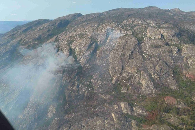
The last major wildfire near Naramata was the Glenfir fire in 2018 that reached over 100 hectares before being put out.
Even communities in the RDOS, such as in Electoral Area H Tulameen, with its single main access, have alternate evacuation plans.
Swift evacuations are at the top of mind for many in communities across the province following the fire that swiftly swept through the town of Lytton.
Those kinds of mass activations for the community would be a joint effort between local fire departments, the emergency operations centre, RCMP, BC Wildfire and any other organization involved.
One of the key things that the RDOS wants residents to be aware of and have ready in the case of a speedy evacuation is their own family preparedness plan.
The details of what those plans include can be found on the RDOS EOC website at emergency.rdos.bc.ca, and includes making sure families have the necessary resources packed and ready to go.
“It has how homeowners can prepare and build a grab-and-go bag in case they have to leave at a moment’s notice, to have food, clothing, water and medication ready, food for their pets to go, and plans that we’re working on with the Ministry of Agriculture for agricultural and livestock,” said Vaisler. “That’s what we want, homeowners to have their plans in place with all the tools we provide them.”
Having people prepared, not only the emergency responders but the residents within the region, is one of the ways that the RDOS hopes to be able to manage the chaos that would come with an evacuation and reduce the stress on everyone involved.
The RDOS’ Emergency Management Program has been building extensive emergency plans since the program began in 2006, including training exercises and evacuation route planning.
In 2019-2020, the Regional District was also awarded $25,000 to revise and update the RDOS Evacuation Route Plan, building an evacuation route dashboard to function alongside the EOC dashboard system used by EOC staff to coordinate community evacuations and emergency operations.
READ MORE: Glenfir fire out of control
READ MORE: Planned burn near Naramata for wildfire management
To report a typo, email: editor@pentictonwesternnews.com.
<>@PentictonNews
newstips@pentictonwesternnews.com
Like us on Facebook and follow us on Twitter.